Online or onsite, instructor-led live QGIS training courses demonstrate through interactive hands-on practice how to use QGIS to analyze, visualize, and manage geospatial data effectively.
QGIS training is available as "online live training" or "onsite live training". Online live training (aka "remote live training") is carried out by way of an interactive, remote desktop. Onsite live QGIS trainings in Transylvania can be carried out locally on customer premises or in NobleProg corporate training centers.
NobleProg -- Your Local Training Provider
Brasov, Calea Bucuresti Street
NobleProg Brasov, 13 Calea Bucuresti Street Sacele, Brasov, romania, 505600
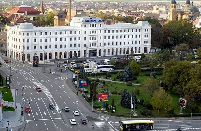
The hotel is situated at the city entrance, being the best conference and training location in Brasov. Three conference rooms can accommodate up to 170 guests and can be modified for the company needs. These training rooms are equipped with the all necessities of a good conference or training.
Salile de training sunt situate central în Sibiu, pe principalul bulevard. Clădirea hotelului care le gazduieste este de factură clasicistă si reprezinta un punct de referinta arhitecturala a orasului.
Turnul Sfatului, Galeria de Arta Contemporana, sau parcurile Corneliu Coposu si Astra se află în imediata apropiere.
Pentru a ajunge aici de la gara, puteti merge pe jos 20min sau cu autobuzul 5 circa 10min
Locuri de parcare găsiți în parcarea supravegheata, sau pe străzile alăturate.
Cluj-Napoca, Pitești Street
NobleProg Cluj-Napoca, Strada Pitești 19, Cluj-Napoca, romania, 400124
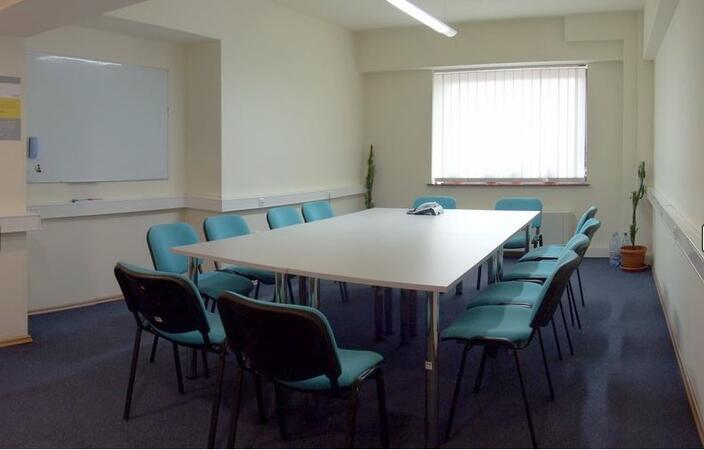
ClujHUB has more rooms for events and training sessions, which can host from 4 to 80 people. These areas can be setup up to fit the companies need. The location is great, 10 minutes walk from the historical city center.
A geographic information system (GIS) is a system designed to capture, store, manipulate, analyze, manage, and present spatial or geographic data. The acronym GIS is sometimes used for geographic information science (GIScience) to refer to the academic discipline that studies geographic information systems and is a large domain within the broader academic discipline of geoinformatics.
QGIS functions as geographic information system (GIS) software, allowing users to analyze and edit spatial information, in addition to composing and exporting graphical maps. QGIS supports both raster and vector layers; vector data is stored as either point, line, or polygon features. Multiple formats of raster images are supported, and the software can georeference images. To summarize it allows the users to Create, edit, visualise, analyse and publish geospatial information on Windows, Mac, Linux, BSD.
This program, in its first phase, introduces the QGIS interface for general usage. In the second phase, we introduce PyQGIS - the python libraries of QGIS that allows the integration of GIS functionalities in your python code or your python application, so that you may even create your own Python Plugin around a particular GIS functionality.
Read more...
Last Updated:
Testimonials (1)
All the topics which he covered including examples. And also explained how they are helpful in our daily job.
Online QGIS training in Transylvania, QGIS training courses in Transylvania, Weekend QGIS courses in Transylvania, Evening QGIS training in Transylvania, QGIS instructor-led in Transylvania, QGIS private courses in Transylvania, Weekend QGIS training in Transylvania, Online QGIS training in Transylvania, QGIS boot camp in Transylvania, QGIS instructor in Transylvania, QGIS trainer in Transylvania, Evening QGIS courses in Transylvania, QGIS one on one training in Transylvania, QGIS coaching in Transylvania, QGIS on-site in Transylvania, QGIS instructor-led in Transylvania, QGIS classes in Transylvania